On October 16, 2017, the People's Committee of BR-VT province issued Decision No. 2916/QĐ-UBND approving “Pilot investment project to apply technology of assembled components protecting riverbanks, lakes and sea dykes to protect riverbanks and seas of BR-VT province”. The implementation period is 39 months from April 2017 to July 2020 (9 months extension) with the objectives: Deploying applications of shore protection components using Busadco embankment technology in Dinh river shore protection works; Monitoring settlement, horizontal displacement, stability of works according to the cycle; Using the Mike 21 mathematical model to analyze and evaluate the impact of the T- shaped welding torch embankment works on the project vicinity areas; Deploying the construction and application of coastal protection components using Busadco embankment technology into Ho Coc coastal protection works; Monitoring settlement, horizontal displacement, monitoring topographic changes in the vicinity of the T- shaped welding torch embankment in each cycle; Summarizing, evaluating and developing a process of technical guidance on the design and construction of Busadco embankment technology applied to river and sea shore protection works in BR-VT province.
Reporting at the meeting, Mr. Hoang Duc Thao said that in phase 1, the project has completed construction of 100m embankment at Dinh river shore and other contents. The technology of assembled components to protect Dinh river shore has been promoting effectively protecting Dinh river shore against landslides on National Highway 51, creating a land area with a width of about 08 m from the traffic safety corridor of National Highway 51 to embankment corridor. In addition, in phase 1, topography, geology and hydrology were also surveyed using the Mike 21 mathematical model.
At the mid-term evaluation and acceptance council on January 8, 2021 for the design and construction plan of assembled components of the coastal protection at Xuyen Moc district, the council had a number of recommendations. The coast of the experimental site still tends to be eroded inland.
Based on the report, proposal of the lead unit, the project manager and the actual survey of the Council, it was agreed that the T- shaped embankment plan does not guarantee the practical implementation feasibility. The replacement of the T- shaped embankment by other types, but still ensuring compliance with the project's objectives is approved by the Provincial People's Committee, in accordance with the provincial sea dyke planning. From the above reasons, there is a need for solutions to keep the current shoreline intact and solutions to prevent the transportation of sediment from the project area to other places, the design adjustment to the embankment solution is absolutely necessary.
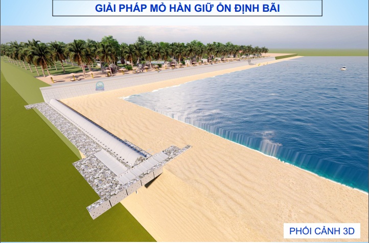
At the meeting, the project manager also proposed a plan to adjust the pilot project to prevent coastal erosion at the community beach of Bong Trang commune, Xuyen Moc district with total length of route and length of protection embankment is 243m.
The use of non-metallic reinforced concrete embankment offers sustainable technical performance and is superior to existing traditional solutions. The investment in the construction of a community beach embankment is to meet the requirements of proactively preventing floods, storms, and sea level rise, limiting damage caused by natural disasters. Moreover, it will mitigate the harmful effects of sea level rise due to global climate change, promote economic development and national security. The route after construction will create more land funds and contribute to the beauty of the area as well as to promote the development of marine tourism.
At the meeting, after discussing issues on scientific basis, technology, equipment and some other related issues of the project, Council members agreed with the proposed plan of the project. However, it is necessary to clarify, edit and complete the explanation documents according to the opinions of the members of the Council.

 Previous page
 Back to top


