 To prepare for the rehearsal against tsunami, which is scheduled this year, Vietnamese scientists have built 25 scripts to give warnings to the people before tsunamis come.
Vietnam also lacks modern equipment and device to take initiative in measuring and giving warnings of quakes and tsunamis.
Scientists said that Vietnam should not be subjective with quakes and tsunamis because it is located in the position where probability of tsunamis is quite high.
A fault in western Philippines can cause quakes of 9 Richter scale and tsunamis. Within 2-3 hours, tsunamis can rush to Vietnam and destroy its central coast.
According to Dr. Nguyen Hong Phuong, deputy director of the Center for Warning of Earthquakes and Tsunamis under the Institute of Geophysics, the 25 scripts are designed based on the nine sources of tsunamis, which can hit Vietnam’s coast. The scripts are also linked with 25 grades of earthquakes in Vietnam.
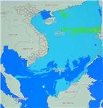
Dr. Phuong said that the most dangerous source of tsunamis is western Philippines (Manila belt). Scripts numbered from 1 to 17 are developed based on different grades of quakes in this seismic belt. Manila belt is over 1,000km long, where quakes of up to over 8 Richter scale were recorded.
Scientists said that quakes in the Manila belt can reach 9 Richter scale. This is the most dangerous belt that can cause large tsunamis to reach Vietnam’s coast. From 1958 to 2005, at least six quakes that caused tsunamis were reported in this area.
The Riukiu fault in Taiwan is another big threat for Vietnam. Scripts numbered 18-19 are designed to cope with quakes occurring in this fault. Quakes in Riukiu fault is estimated to reach 8.5 Richter scale.
Earthquakes in the northwestern East Sea and southern Hainan Island are mentioned in scripts 20 and 21. Small quakes offshore Vietnam’s Vung Tau in 2005 were related to these faults.
Scripts numbered from 22 to 24 are designed for quakes from northern Philippines and southern Taiwan.
The last script is designed for quakes in western East Sea and offshore the central southern region. Quakes in these areas are estimated to less than 7 Richter scale and they many not cause dangerous tsunamis in Vietnam.
Based on the 25 scripts, whenever earthquakes happen in the East Sea, the Center for Warning of Earthquakes and Tsunamis can show maps and give warnings as to when tsunamis will arrive at Vietnam’s coast, the height of tsunami and its impacts on Vietnam’s coast.
The time for conveying quake warnings is nearly one hour
However, Dr. Phuong said that the speed to analyze quake and tsunami data in Vietnam is too long. It takes Vietnamese scientists 20 minutes to define quake parameters and 30 minutes to convey the information.
If script No. 5 happens, with earthquake of 8 Richter scale and tsunami coming in two hours, Vietnam will lose up to 50 minutes for analysis and conveying information and it will have a little over one hour to evacuation.
The number of scripts is too small in comparison with other countries, for example over 100,000 scripts in Japan and 7,000 in Indonesia.
Vietnam also lacks modern equipment and device to take initiative in measuring and giving warnings of quakes and tsunamis.
Scientists said that Vietnam should not be subjective with quakes and tsunamis because it is located in the position where probability of tsunamis is quite high.
A fault in western Philippines can cause quakes of 9 Richter scale and tsunamis. Within 2-3 hours, tsunamis can rush to Vietnam and destroy its central coast.
Dr. Vu Thanh Ca from the Institute for Hydrometeorology and Environment said that on September 11 1904, a rise in sea level destroyed over 22,000 houses, submerged over 500 boats and killed over 700 people in the coast of Thua Thien – Hue province in central Vietnam.
“Vietnam needs to prepare measures to avoid the worst disasters in the context of climate change and natural disasters today,” said Dr. Phuong.
PV

 Previous page
 Back to top
