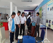
In two days (4th and 5th September, 2014), BR-VT Department of Science and Technology in collaboration with Center for Control and Exploitation of Small Satellites, Space Technology Institute and Vietnam Academy of Science and Technology organized a training course on use and application of remote sensing data to serve socio-economic development of the local officials and officials of departments, sectors, people's committees of districts, cities, universities and enterprises in the province . Mr.Mai Thanh Quang –Director of Department of Science and Technology BR-VT made opening speech of training course. Reporter of training course Mr.Chu Xuan Huy - Center for Control and Exploitation of Small Satellite, Space Technology Institute and Vietnam Academy of Science and Technology.
In two days (4th and 5th September, 2014), BR-VT Department of Science and Technology in collaboration with Center for Control and Exploitation of Small Satellites, Space Technology Institute and Vietnam Academy of Science and Technology organized a training course on use and application of remote sensing data to serve socio-economic development of the local officials and officials of departments, sectors, people's committees of districts, cities, universities and enterprises in the province . Mr.Mai Thanh Quang –Director of Department of Science and Technology BR-VT made opening speech of training course. Reporter of training course Mr.Chu Xuan Huy - Center for Control and Exploitation of Small Satellite, Space Technology Institute and Vietnam Academy of Science and Technology.
Training objective is to provide students with basic knowledge of remote sensing data as well as the need for and importance of exploitation, use and application of remote sensing data in activities of social life to meet requirements of social - economic development, environmental protection and ensuring national security of locality.
Attending training courses, students are introduced to basic concepts of remote sensing, VNREDSat-1 system, the first system of small satellites observing Earth of Vietnam. The reporter also provides knowledge about remote sensing images, through which students are introduced to remote sensing with many applications in various fields. The effectiveness of remote sensing applications not only depends on data source properties, application areas, but also depends on other ancillary data sources, especially field data.
At the training session, the reporter also said that human factor is a decisive significance in remote sensing applications. VNREDSat-1 systems, first satellite on earth observation of Vietnam. Results after one year of operation VNREDSat-1 took 22.895 image scenes which meets the requirements of socio-economic development, ensuring national security, scientific research and training; provide opportunities for the development of powerful applications for remote sensing agencies, government departments, localities.

 Previous page
 Back to top
